Examples of some of the research projects I am leading or involved in.

Environmental chemical exposure has been associated with a variety of adverse health outcomes. Effectively measuring environmental exposure to chemicals is essential to understanding what chemicals an individual is exposed to, and what interventions can be introduced to limit exposure to those chemicals. I am leading a study in the Blue Gap / Tachee community of Navajo Nation to assess potential exposure to metals from abandoned uranium mines and chemicals from unregulated waste disposa and burning.
This study uses a novel approach of passive silicone wristbands to assess individual scale exposure, paired with activity logging, mixed-method interviews, and biomonitoring to build activity-exposure spaces for individual participants. I am working on relating these exposure spaces to predictive models I have developed to assess relationships between individual activity and potential exposure.

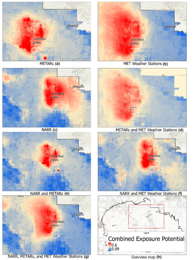
I was co-author and co-lead on geospatial data analysis for a study to predict potential exposure to contaminants from abandoned uranium mines (AUMs) in the Navajo Nation. As part of this study, we also assessed the effect that difference meteorological data sources had on the predictive power of our model. The model was a machine learning (ML) driven GIS Multi-Criteria Decision Analysis (GIS-MCDA) geospatial model that predicts potential exposure to AUMs by considering multiple hydrogeotechnical routes of contaminant dispersal. Results indicated significant variations in model outputs derived from different wind data sources. After model validations against ground-truth soil data in a geographically weighted regression (GWR), we determined that ASOS station data combined with local MET station data showed the highest overall accuracy. This study is an example of my geospatial datascience, ML, scientific writing, and teamwork skills.
The publication for this study can be found HERE

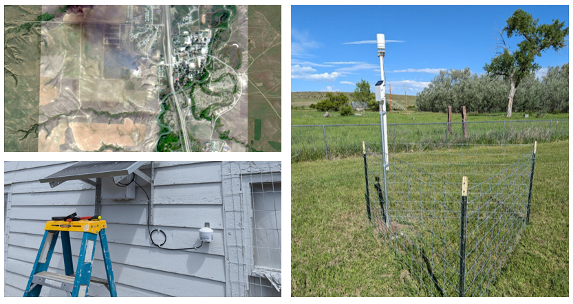
I am lead author on a study investigating combustion of solid waste at disposal and recycling facilities across the U.S. We developed a approach using remote sensing to comprehensively monitor waste fires and landfills, recycling plants, and unregulated sites. Fires were identified through news reports and dialogues with community partners. We tested the utility of the NASA Fire Information for Resource Management System and high resolution satellite imagery from Planetscope for fire monitoring. Additionally, we assessed the effectiveness of low-cost, community air sensors at detecting potential increases in particulate matter (PM) levels during fire events. We found that 42% of reported fires were detected, and that elevated PM levels were detected during 22% of burn events. Results demonstrate the potential of remote sensing methods in small-scale fire detection and large-area surveillance, thereby revealing the scope of this public health challenge while supporting emergency response, health studies, and decision-making processes. A manuscript for this study is currently in preparation. This study is an example of my remote sensing, geospatial data science, community engagement, teamwork, and scientific writing skills.

I am a lead geospatial analysist on this project to assess environmental exposure in Tribal communities in Montana and New Mexico. This project encompasses multiple subprojects included a remote sensing analysis of waste fires, air quality monitoring, and personal exposure assessment. We are assessing the utility of the NASA Fire Information for Resource Management system combined with Plaentscope satellite imagery for monitoring of fires at unregulated waste disposal sites. We are also undertaking environmental monitoring through the installation of meteroogical stations and particulate matter monitors. MET stations have been installed in partnership with Montana Mesonet, a division of the Montana Climate office. For air quality monitoring, I designed a solar-powered station with cellular-telemetry for real-time data upload/access, using a particulate matter (PM) sensor from PurpleAir. This study is an example of my geospatial datascience, remote sensing, environmentalmonitoring and field skills, and teamwork and community engagement skills.
The installed MET stations for this study can be found HERE
The installed air quality stations for this study can be found HERE
See HERE for an NIEHS airticle summarizing this work.

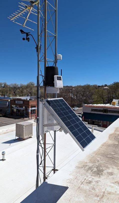
I am a lead geospatial analysist and field researcher on this pilot project to leverage community partnerships and provide a novel framework for community based air quality monitoring. This study, which is also a component of my doctoral work, integrates geospatial models with the installation of local sensor networks and community input for air quality modeling and assessment in Grant County, New Mexico. This study is being conducted in partnership with the Gila Resource Information Project (GRIP), a local community environmental organization. Besides monitoring and modeling PM levels, we are assessing the utility of including community knowledge into modeling frameworks using a mixed-methods process based on the Analytic Hierarchy Process (AHP) combined with machine learning (ML) driven model weighting factors. The model is based on a machine learning (ML) driven GIS Multi-Criteria Decision Analysis (GIS-MCDA) geospatial model that predicts potential exposure to PM released from mining activities in the area by considering multiple hydrogeotechnical routes of contaminant dispersal and the influence of industrial emissions and wildfires. For air quality monitoring, I designed a solar-powered station with cellular-telemetry for real-time data upload/access, using a particulate matter (PM) sensor from PurpleAir. This study is an example of my grant writing, community engagement, environmental monitoring, and geospatial data science skills.
The installed air quality stations for this study can be found HERE

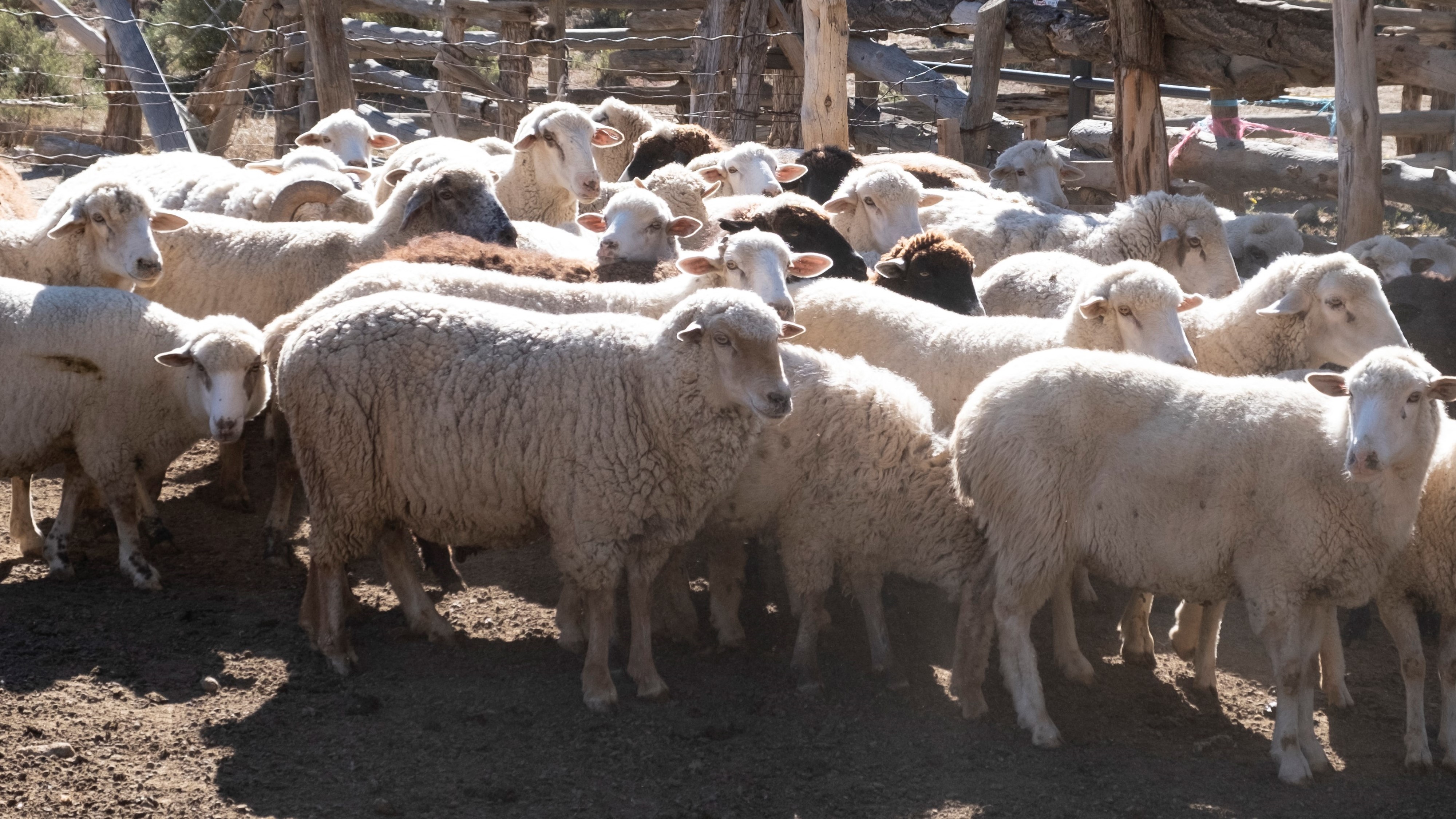
Livestock are a significant potential pathway of contaminant uptake and community exposure. We use GPS collars, passive silicone samplers, and leverage GIS models to assess potential exposures for livestock. GPS data is input into a neuro-fuzzy inference system to classify the spatial distribution of different animal behaviors such as grazing, resting, and traveling. These behaviors may impact the potential for an animal to be exposed to AUM contaminants.